
July 3, 2024
By John DeVoe with Tommy Hough
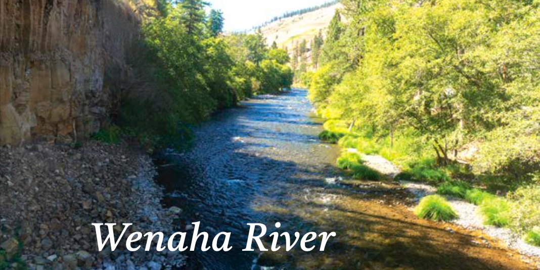
Wenaha River
Tim Palmer’s Field Guide to Oregon Rivers calls the Wenaha “one of the Northwest’s wildest streams … with no roads, dams, development or diversions.” He should know. A few years ago, Tim and a couple of friends hiked up the Wenaha from the lower end of the river near Troy and packrafted back down to the mouth at the Grande Ronde River in an adventure filmed for an Oregon Field Guide segment. The headwaters of the Wenaha flow out of the Wenaha-Tucannon Wilderness along the Oregon-Washington border through a canyon for about 35 miles, and Trail 3016 in the Umatilla National Forest follows the Wenaha along the southern portion of the Wilderness from a trailhead just outside Troy. Fishing is said to be good, with stunning scenery throughout. The river is a refuge for Bull Trout, and there are plenty of bears and other wildlife.
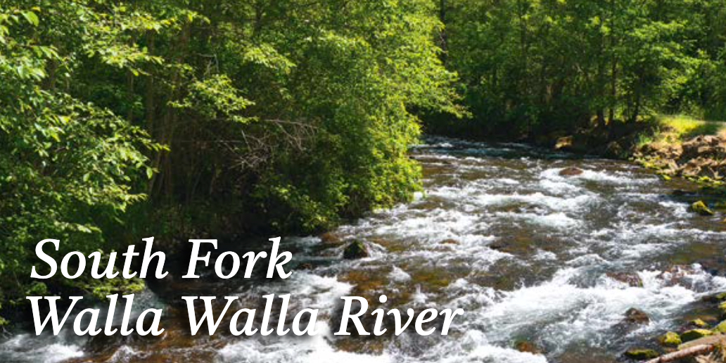
South Fork Walla Walla River
Another somewhat notorious bear and rattlesnake hangout, the South Fork of the Walla Walla joins the North Fork to create the mainstem Walla Walla River about five miles east of Milton Freewater. Trail 3225 begins at a trailhead on BLM land about three-quarters of a mile past Harris Park ( * ), and meets the boundary of the Umatilla National Forest about three miles in on its route between Harris Park and Deduct Springs. About 20 miles of this trail above Harris Cabin to Deduct Campground is designated for hikers only. While the upper portion of the canyon can be accessed via Forest Road 65 at the Deduct Trailhead, that involves a somewhat long, steep downhill hike. Best to go up from the bottom, but be aware of flood damage and debris the first few miles. The South Fork has good fishing and supports bull trout in its upper reaches.
( * ) Note: WaterWatch supporter Troy W. Baker, executive director of the Walla Walla Basin Watershed Council, caught an error in this entry. According to Troy, “The article mentions the trail is open from Harris Park to Deduct Campground. However, this information is currently inaccurate. The first approximately five miles of the trail are closed due to the road and a section of the trail being washed out above the Harris County Park Campground following the 2020 flood. As a result, there is no access to the BLM South Fork Walla Walla River Trailhead from Harris Park. At the end of the road just above the Harris Park Campground, the BLM has posted signs indicating that the trail is closed. Hikers can access the lower/middle South Fork Walla Walla River Trail by driving to Target Meadows Campground and proceeding to the Burnt Cabin Trailhead. The Burnt Cabin Trail 3226 has been reopened thanks to a new bridge across the South Fork Walla Walla River installed in 2023. The upper South Fork Walla Walla River Trail is open, and you can access it at the Deduct Trailhead. I appreciate the highlight of the South Fork, as it is a treasured resource. Just wanted to let you know the current conditions to ensure hikers and visitors are correctly informed. Best regards.” Many thanks Troy!
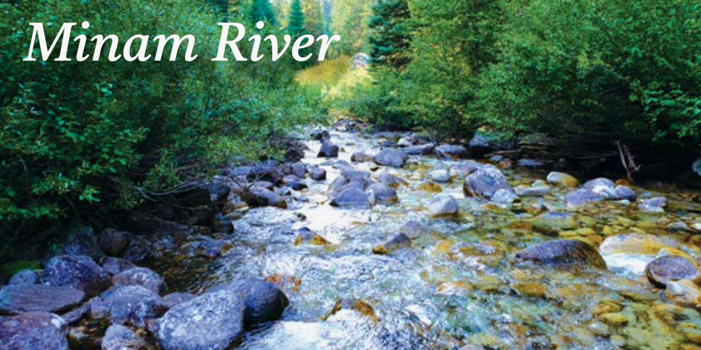
Minam River
Located just outside the town of Minam in Wallowa County on Oregon Highway 82, the Minam River Trail 1673 was initially a logging road along its lower eight miles, and you can follow the river for 39 miles to its headwaters at Minam Lake along this trail. Fishing is fun along the river’s length, and it gets even better later in the season. For a special treat, consider hiking into the Minam River Lodge to be pampered by great food, hot tubs and other amenities for a relaxing and unique getaway. Or, to sample two great northeastern Oregon rivers, backpack up the Lostine River from the Two Pan trailhead to the Lakes Basin, then cross the divide into the Minam watershed and hike down the Minam River itself. There are dozens of spectacular trails in this portion of the Wallowa-Whitman National Forest and plenty of loop options, but consult an Eagle Cap Wilderness map for greater detail of the Minam River.
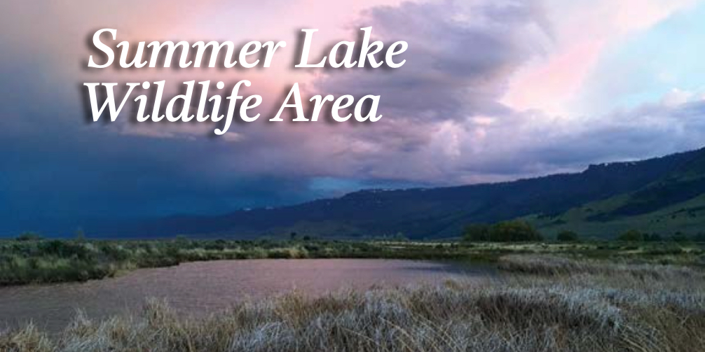
Summer Lake Wildlife Area
If you’re a birder, don’t leave your binoculars at home for this hike. Summer Lake is one of five major wetland areas in the Great Basin, with over 250 species of birds found during the year, including some 25 species of shorebirds, large populations of lesser snow geese, and nesting populations of white faced ibis. Located in central Lake County along Oregon Highway 31 about 100 miles southeast of Bend and 75 miles northwest of Lakeview, breeding waterfowl and shorebirds are commonly found here during the summer, though the spring months tend to welcome a more diverse array of brightly plumaged ducks, geese, swans, migrant shorebirds, and other waterbirds and songbirds that pass through along their route on the Pacific Flyway. Summer Lake is also one of the key areas in the state where WaterWatch has worked to preserve and restore groundwater by preventing excessive pumping from drying up the source of the springs that feed the wetlands at Summer Lake.
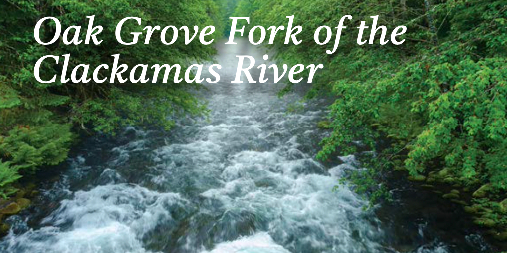
Oak Grove Fork of the Clackamas River
Close to Portland, the Oak Grove Fork of the Clackamas has benefitted from WaterWatch’s work in a legal settlement that involved the Portland General Electric (PGE) Clackamas River hydroelectric project, which compelled the utility to rewater the Oak Grove Fork below Timothy Lake. While there is no trail along the Oak Grove Fork, the partially paved and mostly gravel Forest Road 57 does follow the river from the Ripplebrook area southeast of Estacada all the way to Timothy Lake near Highway 26 in the Mount Hood National Forest. From there you can hike down to the river at several points. Fishing is fun for smaller trout and the occasional whopper that migrated out of Harriet Lake into the river. Consult your Mount Hood National Forest map for details on camping and other Forest Service roads in the area that access some of the small lakes high above the Clackamas River.
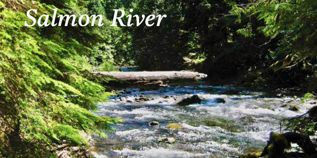
Salmon River
Straddling the geologic regions of the Columbia Basin and Cascade Range, the Old Salmon River Trail 742A is another close-to-Portland hike that may seem like an obvious option to veteran Mount Hood hikers, but is no less spectacular as one of the best river and old-growth forest hikes in the Pacific Northwest. Accessible year round, the Salmon River is also the rare example of a low-elevation river and forest ecosystem that survived the saw for decades before its preservation in 1984 as part of the Salmon-Huckleberry Wilderness. With the destruction of Opal Creek and much of the Santiam River environs by wildfire in 2020, the preciousness and proximity of this natural gem to Portland and Salem is even more apparent. Visit in the summer to escape Willamette Valley heat, visit in winter for supreme riverside solace, or visit in the autumn while salmon pump their way upstream over waterfalls along miles of exploding fall colors.
This article originally appeared in the summer 2024 issue of WaterWatch of Oregon’s Instream newsletter.