
March 19, 2024
By John DeVoe and Tommy Hough
From flowering cherry blossoms and happy daffodils, to explosions of pollen clouding car windows from Astoria to Klamath Falls, there’s no doubt spring has arrived in Oregon.
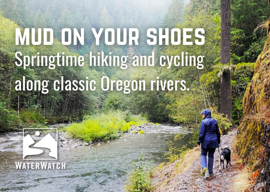
And if the longer days and warmer weather haven’t already sent you into the garage to search for your hiking gear, perhaps these river hikes and cycling options along some of Oregon’s best-known and scenic rivers, as suggested by WaterWatch’s John DeVoe, will prompt you to hit the trail and get some springtime mud on your shoes. Additional thanks to WaterWatch supporter and outdoor author Tim Palmer, author of the Field Guide to Oregon Rivers and other titles, for generously sharing two of his photos for this piece!
While conditions are always subject to change, the options listed here are primarily located at lower elevations, where you can get back to conditioning for more uphill excursions into the high country during the summer. As always, check current conditions before you leave home, observe Leave No Trace wilderness ethics, and be sure to bring water, food, a flashlight, socks, and layered clothes when heading off on an adventure.
And despite how refreshing the water may appear in the rivers mentioned in these outings, be sure to maintain your awareness and respect for the potential dangers of cold water, which can be even more powerful than usual during spring runoff. At less than six inches you can be swept off your feet by moving water, and this time of year river water in Oregon is positively frigid. Be smart, hike with a buddy, and don’t become a statistic.

Lower Deschutes River Trail
One of the most enchanting riverside mountain bike and hiking trails in the west, the Lower Deschutes River Trail travels about 12 miles up the east bank of the river from the mouth of the Deschutes at the Columbia River. Intrepid hikers and bikers who don’t mind rough conditions and a lot of blackberries can push all the way to Trout Creek and on to Maupin on a combination of rough, undeveloped trails, gravel, and paved roads.
Bikepacking, backpacking, hiking, and fishing are all available along this trail following the route of an old railroad bed. While relatively flat, winds can be fierce through the canyon, although one direction usually gets a tailwind on this out-and-back route. If you opt to bike the trail, be sure you’re equipped to address punctures with a repair kit and pump (or walk back the 12 miles from Harris Canyon to the trailhead as John did once). Also, bring plenty of water and sunscreen. Shade is at a premium here in hot weather.
To get to the trailhead take exit 97 off I-84 for State Route 206 to Deschutes/State Park/Celilo, and take Route 206 three miles to the mouth of the Deschutes River. Turn right on the east bank into the recreation area, where you’ll find the trailhead on your left with some designated parking. An Oregon State Parks parking pass is required and can be purchased onsite for $5.

Lewis River Trail
One of the great riverside trails in the Pacific Northwest is located relatively close to Portland, but in Washington. The Lewis River Trail follows the river named for Meriwether Lewis of the 1804-06 Lewis and Clark Expedition for about 15 miles through some of most magnificent, surviving mature and old-growth forest remaining in the Gifford Pinchot National Forest, with several impressive waterfalls along the way.
The trail is suitable for hiking and mountain biking, and cyclists can go out and back or head back to the starting point/car via forest service roads. More information, including maps, trail descriptions, and parking pass information are available at the Gifford Pinchot National Forest website.
While there are several trailheads for accessing the Lewis River Trail, the most commonly used are via Forest Road 90, including the Lewis River bridge, which requires a left turn from Road 90 onto Road 9039 and a one-mile drive to the namesake bridge. The second is accessible via the Lower Falls Campground off Forest Road 90, and the third can be reached via Trail No. 5 at the Quartz Creek bridge off Forest Road 90.

Metolius River Trail
The magical Metolius River truly offers outstanding hiking and angling opportunities. You can hike (and fish, but note seasonal regulations above Allingham Bridge) from Camp Sherman to Lake Billy Chinook. There are trails on both sides of the river, although the trail on the west bank and any west bank fishing ends at Candle Creek at the boundary of the Warm Springs Indian Reservation.
Below Bridge 99, the trail enters wilder country until it emerges at Lake Billy Chinook. This area is suitable for a quick backpack. Be sure to visit the headwaters of the Metolius on your way to the trailhead for a lesson in the importance of groundwater to Central Oregon’s rivers — and many other rivers across the state for that matter. Any questions about fishing the Metolius or surrounding waters should be directed to The Fly Fishers Place in Sisters.
From U.S. 20 and State Route 126 northwest of Sisters, head north on County Road 14 toward Camp Sherman in the Sisters Ranger District of the Deschutes National Forest. Go left on County Road 1419 at two-and-a-half miles, then head straight on Forest Road 1420 toward Sheep Springs Horse Camp. Over the following four miles the road surface deteriorates, so be wary of using this road in rainy weather and without a high-clearance vehicle. Turn right on Forest Road 1420.400 with Lower Canyon Creek Campground as your destination to access the West Bank Metolius trailhead.

Elk River and the Wild Rivers Coast Scenic Bikeway
For cyclists who get to the southern Oregon Coast, this 61-mile ride travels along the amazing Elk River for 17 mile, accesses the Grassy Knob Wilderness in the Rogue River-Siskiyou National Forest, Cape Blanco State Park, the Sixes River and a great beach to look for agates at namesake Agate State Beach, and Tseriadun State Recreation Site. The Elk River is a true sanctuary and stronghold for wild salmon and steelhead on the Oregon Coast. In Port Orford, you can walk the short but ridiculously beautiful trails of Port Orford Heads State Park.
Expect light traffic, amazing beaches, blue pools on the Elk River, empty beaches at Cape Blanco and, if you take a little detour north to Langlois on U.S. 101, you can get great sandwiches at the Langlois Market. More information, maps and GPS coordinates can be found at the Travel Oregon website.

McKenzie River Trail
This justifiably popular trail on the Upper McKenzie River travels past amazing volcanic geologic features, waterfalls, and offers a developed hot springs resort pool at Belknap Hot Springs to soak away any aches and pains picked up along the hike. The trail is very scenic and can be busy — with good reason. There’s a lot of sharp lava on this trail so good shoes are a must, and you may want to leave the dog at home for this one. As with all National Forests in the region you will need a Northwest Forest Pass, with day or annual passes available online, to park your car.
To access the upper trailhead go south on State Route 126 (McKenzie Highway) from its junction with U.S. 20 for two miles and turn left at the Old Santiam Wagon Rd. The lowest trailhead can be reached about one-and-a-half miles east of the community of McKenzie Bridge. For more information, visit the Willamette National Forest website.

Donner ünd Blitzen Trail
South of Burns, the Donner ünd Blitzen River Trail offers high desert flora and fauna next to the namesake Donner ünd Blitzen River, which flows out of the Steens Wilderness and is a true desert gem in a very dry part of the state. There are also worthy trails on the Little Blitzen and Indian Creek, both tributaries to the Donner ünd Blitzen with plenty of redband trout. Managed by the federal Bureau of Land Management, the trail is not particularly strenuous, and you can hike as far upstream as you like before returning to the Page Springs Campground trailhead. A good place to see a cougar. Can be very hot in the summer. Also, a good place to see a rattlesnake.
To reach the trailhead, travel to French Glen south of Burns via State Route 20, and then head to the Page Springs Campground area just east of French Glen. For a hearty breakfast, try the Frenchglen Hotel. If the road is open, be sure to drive or mountain bike the Steens Mountain Road for awe-inspiring views of this remote part of Oregon.
Special thanks again to Tim Palmer for his kind courtesy in sharing his photos of the Elk River and Donner ünd Blitzen River with WaterWatch for this project. Photos are all rights reserved, and not intended for republication. Banner photo of the Salmon River in Mount Hood National Forest by Tommy Hough.