Feb. 26, 2025
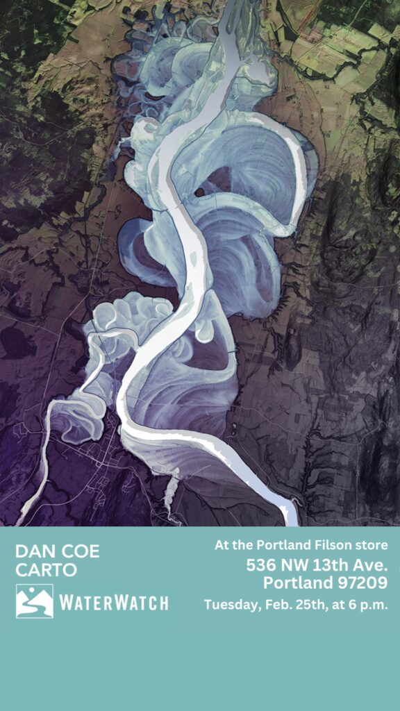
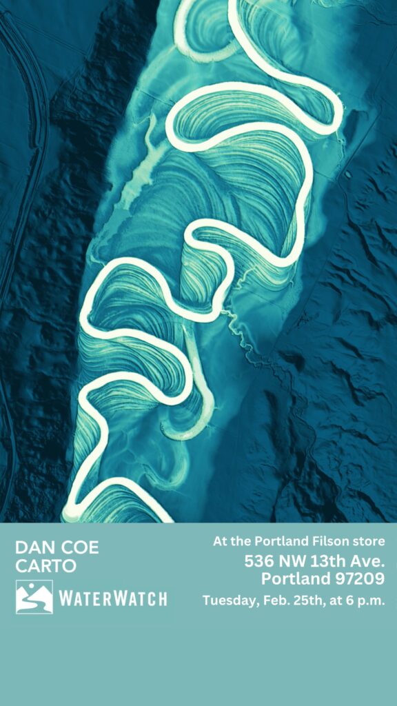
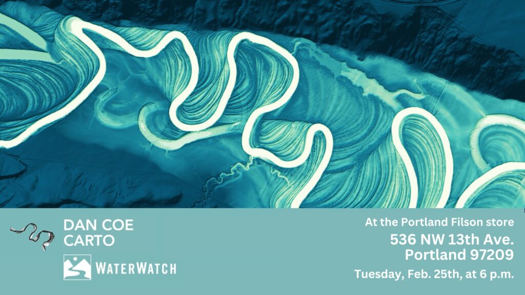
You may recall the fascinating image of the Wild and Scenic portion of Rogue River featured on the cover of the fall issue of our Instream newsletter, created through the use of a remote sensing technique called LiDAR, which is an acronym for Light Detection and Ranging, which uses lasers to create three-dimensional models of the earth’s surface.
The cartographer, photographer, and artist behind that image is Daniel Coe, who has produced hundreds of similar designs using LiDAR technology and designed maps for National Geographic, High Country News, Atlas Obscura, American Scientist and other publications. These vibrantly detailed, layered images of rivers and floodplains include several Oregon rivers that WaterWatch has spent portions of last 40 years working on by restoring access for native fish, and guaranteeing the instream rights for the water flowing in them.
We’d like to thank Daniel Coe for his fascinating presentation at our Feb. 25th event with him at the Portland Filson store in the Pearl District, where he showcased dozens of his images and photography with a conservation message, and shared some of the stories behind these remarkable visuals.
We’d also like to thank Daniel for his generous contribution of a portion of his sales from that week to WaterWatch, and for the wealth of prints he shared with us that we will utilize in upcoming raffles at future WaterWatch events and auctions — thank you!
Visit our WaterWatch Flickr account for a gallery of photos from our Feb. 25th event with Daniel at the Pearl District Filson store.