
By Michael Kohn | April 13, 2024 | Bend Bulletin
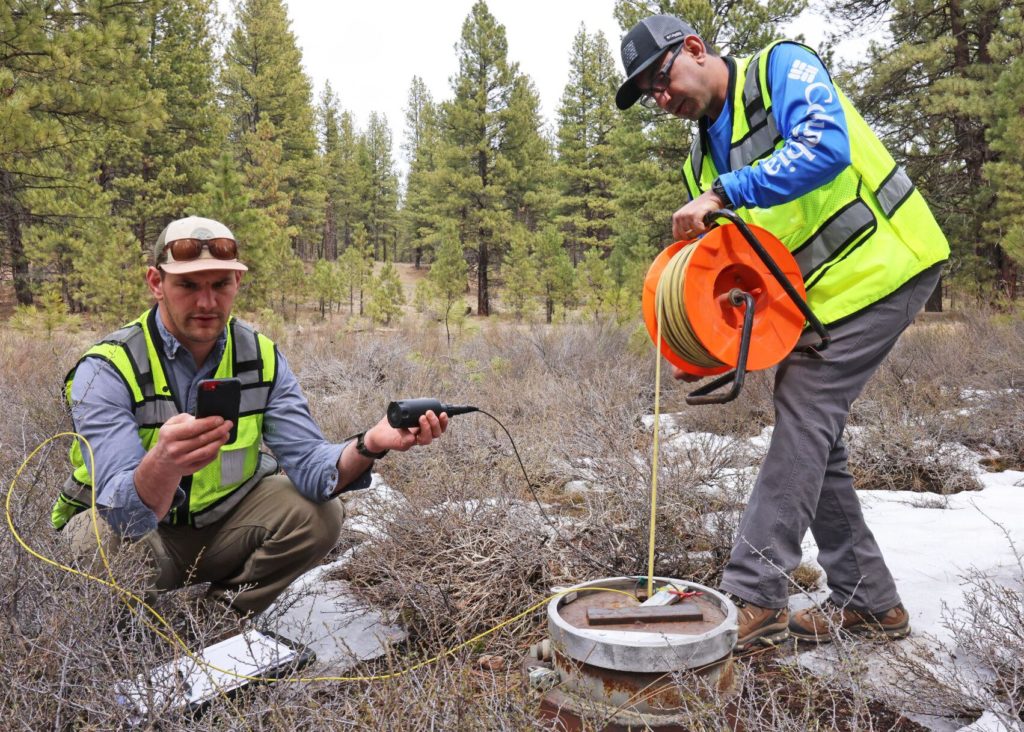
Amid patches of snow and ponderosa pines, a half mile from Lava Island Falls in the Deschutes River, a pair of hydrologists with the Oregon Water Resources Department dropped a cable down an observation well to determine the depth of groundwater near Bend.
The cable unwound 169 feet until a beeping sound indicated it finally hit groundwater.
The hydrologists took measurements by hand while other devices attached to the well transferred additional data to their phones.
“It’s down a little bit now, reflecting the recent drying trend over the last seven years or so,” said Joe Kemper, one of the hydrologists. “This one gets some recharge from the river.”
The well data showed the water level had dropped three to five feet since 1993. Other wells haven’t been so lucky. In the same period, wells in the center of the Deschutes Basin near Bend and Redmond have dropped 35 to 40 feet.
Kemper said the alarming drop in groundwater levels is mostly attributed to drought and climate change.
For every 10 inches of water level decline, roughly six inches can be attributed to Central Oregon’s recent dry conditions. Around one to two inches of any 10-inch loss is caused by canal piping — piping doesn’t leak like canals do, so the more pipes installed, the less water there is available to sink into the ground.
The remaining 20 to 25 percent of declines in groundwater is caused by the collective use of Central Oregonians flushing their toilets, taking showers and, mostly, watering their lawns, Kemper said. The problems facing the aquifer have only snowballed over time.
“Each one of those stressors has persisted or worsened,” he said.
This is a cause for serious concern, said Michael Coiner, a spokesperson for the Oregon Water Resources Department (OWRD).
“In some parts of the state, water pumped and used from underground aquifers is far outpacing what nature can replace through precipitation,” he said in an email.
Coiner reports recent scientific data shows that groundwater depletion is occurring at a “rapid and unsustainable rate” in some areas of Central Oregon.
“Water is a finite and critical resource,” said Coiner. “With groundwater sources declining, reduced surface water flows in streams, rivers, and lakes inhibit healthy fish, aquatic habitat, and recreation.”
Revising Groundwater Rules
The reports of dropping water levels are pushing officials to act. One of the most wide-reaching actions is being undertaken by the Oregon Water Resources Department, which is proposing revised rules to limit groundwater use by communities.
The changes could prevent cities, businesses and farmers from sinking new wells if data shows groundwater usage isn’t stable. It helps to know a little bit about this underground resource to understand why local and state officials are so concerned.
The Deschutes aquifer is highly porous, over 1,000-feet thick, and able to store vast quantities of water in its cracks and fissures. This water occasionally finds its way to the surface as springs, forming creeks and rivers. The water level in the aquifer can fluctuate from year to year, based on climate, rising one year and dropping the next.
The aquifer sprawls across a vast swath of Central Oregon. Its makeup includes volcanic rock, ash and the leftover sediment from ancient rivers.
But over the past three decades, water levels overall have dropped.
“On average it has been declining a foot a year since the 1990s,” said Kemper. “The last five or so years it has been particularly dry, so declines are up to two feet a year. It’s hard to say how long that will go.”
Springs and Wells Going Dry
The lowering of the aquifer is clear to hydrologists monitoring groundwater discharge, but outdoor enthusiasts have probably also spotted changes at their favorite springs. The headwaters of the Metolius River are an obvious example — its discharge has dropped 55 percent in just the past six years.
That has hydrologists and community leaders sounding alarm bells over water consumption.
Some small steps have begun to encourage conservation. Earlier this week, the city of Bend announced it would help financially support residents ripping out their lawns and trying xeriscaping, a type of landscaping that uses little water and reflects the natural landscape.
Deschutes County Commissioner Phil Chang sees other opportunities to conserve groundwater. He points to wells on rural residential properties as low-hanging fruit. These wells are exempt from water fees and are entitled to pump up to 15,000 gallons of water out of the ground daily and without cost. Meters are also not required on these wells.
“Most are not using 15,000 gallons per day, but they can take that much and they are allowed half an acre of irrigated landscape. That is a massive amount of water for one household,” said Chang.
Deschutes County has around 16,000 exempt domestic wells, but with no system to encourage water conservation, they are beginning to cannibalize each other. More than 200 wells have gone dry in the past three years, Chang says.
Last year, the Oregon Water Resources Department said more than 130 people in Central Oregon were seeking financial assistance to repair wells, mainly due to the dropping aquifer, including 114 homeowners in Deschutes County. The cost to repair a well varies depending on several factors but can range from $9,000 to $55,000, said Alyssa Rash, a spokesperson for the department. That is an expense many can’t afford.
“Collectively, exempt groundwater users may be harming each other,” said Chang.
The new rules proposed by the Oregon Water Resources Department won’t impact exempt wells on rural residential properties. They will only make it more difficult for municipalities to sink wells and will result in fewer new water rights applications being granted.
Incentives Needed
Chang said what’s needed is a system to encourage exempt rural residential properties to conserve groundwater. This could include more incentives to replace turf with landscaping that requires less water.
“The landscape stuff is where most water gets used. You can put in low-flow flush toilets. You can change out showerheads. But the majority of water use in our community is going in the yard,” he said. “If they’re allowed to have half an acre, pay them to tear out a quarter of an acre.”
Back at the well near Lava Island Falls, the two hydrologists reeled their measuring cable back onto a giant spool and prepared to head to other wells in the area around Sisters to take more measurements. They do this for a week, four times a year, providing results that could help the aquifer recover.
Kemper said the findings should be a wake-up call.
“A lot of people hear about the thickness [of the aquifer] and say oh, we can do this for another thousand years. But I just think of how many people’s wells will go dry if we just decline another 50 feet,” he said. “The upper extent is supplying water to the Deschutes and Crooked Rivers. The upper extent is also used for wells. That is practically usable water.”
This article originally appeared in the April 13, 2024 issue of the Bend Bulletin.