

By WaterWatch Staff | April 6, 2022 | Instream
While groundwater permitting standards require Oregon to determine whether water is available before issuing a new groundwater permit, in practice, the state all too often lacks enough data to make that determination. As a result, and a habit, the Oregon Water Resources Department (OWRD) often operates on a “default to yes” approach that continues to cause huge problems for basins reliant upon groundwater around the state. Here are four case studies of some of the most notorious examples of groundwater over-allocation in Oregon, but make no mistake: despite the tale of four basins here, this a rapidly-growing problem throughout the state — and the west.

Deschutes Basin — Protecting Oregon’s Crown Jewel from Groundwater Pumping
Problem: In the Deschutes Basin, over a century of water diversions for irrigation have taken a heavy toll on the river. In the early- to mid-1990s, this problem was compounded by burgeoning population growth in Central Oregon. With no water rights available from the river, cities and others began to turn to groundwater. However, in the Deschutes Basin, groundwater is closely linked to flows in the rivers and streams, meaning that underground sources feed streamflows. Increased groundwater pumping meant less water for fish, wildlife and recreation, and harm to Scenic Waterway flows and senior instream water rights.
Consequence: Protected streamflows in the Deschutes River basin were being harmed by groundwater pumping.
Solution: Luckily, in addition to being one of Oregon’s most beloved rivers, the Deschutes is also one of the state’s most protected. Thanks to WaterWatch’s work, 93 instream water rights in the basin preserve streamflows for fish and wildlife. And the state Scenic Waterway Act prohibits the allocation of new water rights, including groundwater rights if scenic flows are not being met.
Our Work: Given this level of protection for Deschutes River flows and studies dating back to the 1920s that identified the connection to groundwater and surface water, when applications for new groundwater rights exploded in the mid-1990s, WaterWatch challenged every single one as violating the Scenic Waterway Act. This in-the-trenches work set the trajectory for the groundwater management program today that is viewed as a model across Oregon and the West for managing ground and surface water together as a single water source.
WaterWatch’s challenges led to attempted end runs in the Oregon Legislature to exempt groundwater from Scenic Waterway Act protections. We successfully staved these off and gained explicit protection of scenic flows from threats of groundwater pumping. Our work also led to Oregon completing a joint basin groundwater study with the U.S. Geological Survey. In the late 1990s preliminary study, results showed that groundwater pumping reduced protected Scenic Waterway flows in the Deschutes Basin. This led to a temporary moratorium on new groundwater rights, and eventually the Deschutes Groundwater Mitigation Program.
While not perfect, this program creates a framework that requires new groundwater pumpers to mitigate the impacts on rivers and streams, which has generally been achieved by leasing or purchasing surface water rights to be legally protected as streamflow. This mitigation water must go instream at or above the zone or stream impacted by new groundwater pumping. The program also sets a cap for new groundwater pumping that cannot be altered unless Scenic Waterway streamflows are maintained.
The program is not without issues. For example, there is no timing requirement to ensure year-round impacts to streamflows from groundwater pumping are offset by mitigation — which typically relies on water rights that are leased or purchased but only can be used during the irrigation season. The program also does not protect water quality or cold water springs. And exempt wells (those that do not require a water right) are not required to mitigate for their impacts. Over the past two decades, these and other issues have been highlighted in legislative reports; however, no action has taken place to address them. With the program nearing its cap, these issues will likely come to a head. We expect a state workgroup will be convened to resolve these longstanding issues, as well as new ones that have arisen in the face of declining groundwater levels in select parts of the basin.
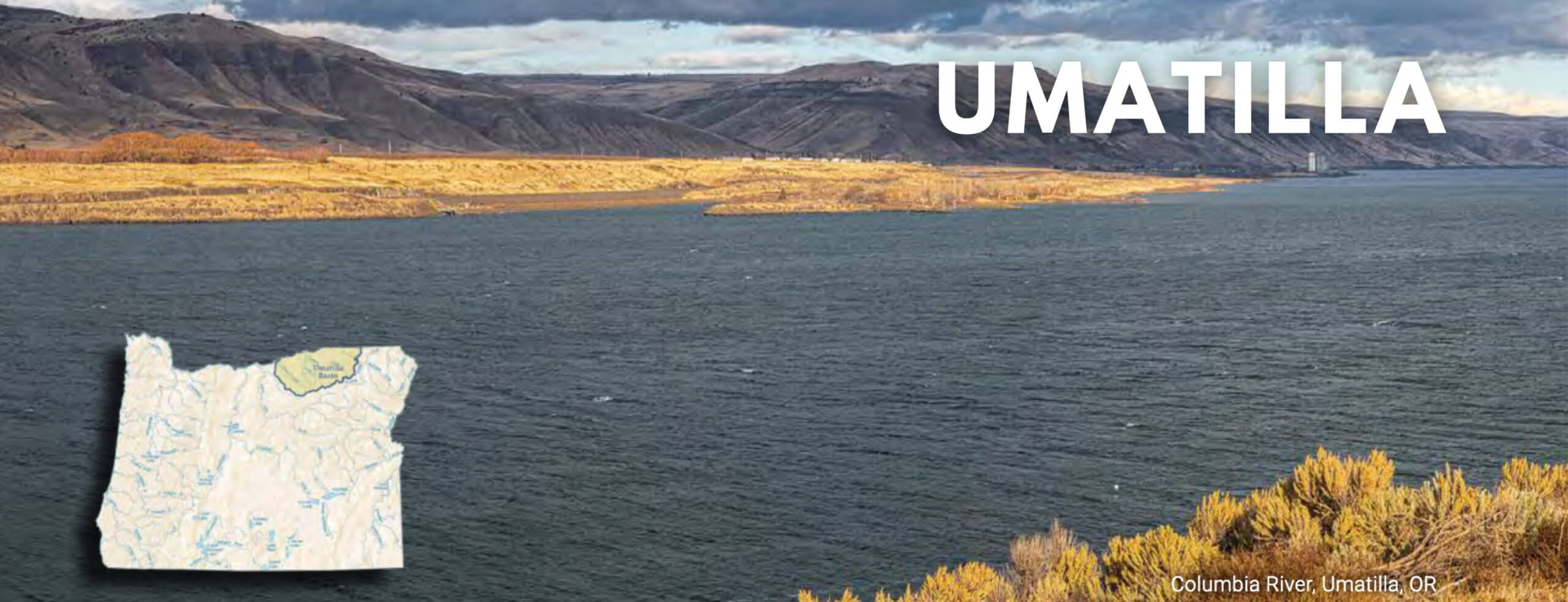
Umatilla Basin — Protecting Critical Aquifers from Further Decline
Problem: Excessive groundwater permitting by Oregon and excessive pumping by irrigators resulted in severe declines in local aquifers of several hundred feet and mining of over 20,000-year-old groundwater. More recently, new proposals to site so-called mega dairies in the area (with water footprints equal to the city of Bend) add additional strain and complexity to an already water-scarce area. Attempts were made to use a loophole in water law called the “stockwatering exemption” to pump large amounts of groundwater without any water right to use as drinking water for the cows.
The proposed site for one new dairy, called Lost Valley Farm, had water rights from the Columbia River to irrigate crops to feed the cows and absorb nitrates in the animal waste, but it needed an additional one million gallons of water a day for drinking water for the cows (30,000 proposed) and for dairy operations, such as washing barns and running machinery. The dairy proposed to get that water from both shallow (alluvial) and deep (basalt) groundwater aquifers, in part by exploiting an exemption in the permitting laws for stockwatering. As the Water Resources Department told the dairy’s owner in a 2016 letter, the proposed stockwatering alone could increase demands on the Ordnance Basalt Critical Groundwater area, where groundwater levels were already declining by about two feet per year, by as much as 50 percent.
The area at the northern end of the Umatilla Basin already has several large dairies, primarily to supply a Tillamook brand processing plant in the nearby town of Boardman. The existing dairies include Threemile Canyon Farms, which, with about 70,000 cows, is one of the largest dairies in the country.
Consequence: For many years, local streams and rivers suffered and some surface water right holders lost the ability to use their water rights. New proposals could draw down already compromised aquifers.
Solution: Solutions are complex in the Umatilla, but one rational solution is to not allow misuse of the stockwatering exemption. Another solution is to stop expecting that all lands below a certain mean sea level will be irrigated in the basin, as many agriculturalists currently do.
Our work: WaterWatch has a long history of working on groundwater issues in the Umatilla Basin in Northeastern Oregon. Most recently, we joined a coalition opposed to new mega dairies in the area because of their potential to strain sensitive water supplies, including groundwater aquifers already designated as being in critical condition because water users are taking out more than the aquifers can give on a long-term basis.
We successfully fought the new dairy’s efforts to add unsustainable new groundwater demands to the area and, after a brief period of operation in which it trucked water to the site, the dairy shut down. A new dairy proposed for the site, Easterday Dairy, was put on hold after one of its owners admitted to a criminal fraud scheme but, to the extent that dairy moves forward under the remaining owners, it has agreed not to use the stockwatering exemption to tap critical groundwater supplies in the area. The attention we brought to the issue helped secure that result. Meanwhile, the potential for more mega dairies in the Umatilla Basin continues to pose a threat to water supplies generally in the area.
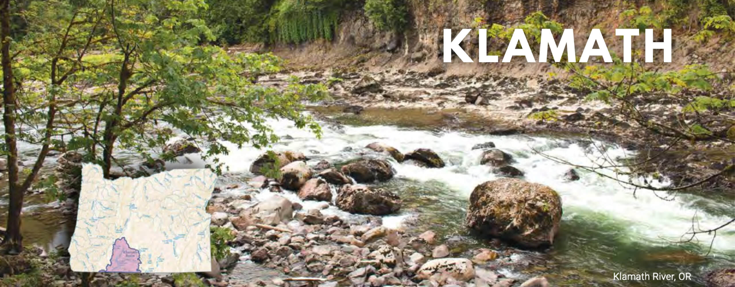
Klamath Basin — Groundwater Crisis a Harbinger of Rural Oregon’s Future
Problem: Since 2001, Klamath Basin agribusiness — which consumes over 90 percent of developed basin water supplies — has been unable to divert unsustainable amounts of surface water from rivers and streams due to collapsing native fish populations and the belated acknowledgement of the first-in-line priority of Native American water rights sufficient to support harvestable populations of fish. Rather than heed repeated warnings from scientists and others that groundwater subsidies were counterproductive and wasteful — and instead, fund programs to voluntarily bring demand for water into balance with actual supply — our elected leaders chose to fund two decades of groundwater mining.
Meanwhile, state enforcement against water cheats remained chronically weak, even as state water regulators greenlit more and more groundwater development.
Consequence: The Klamath Basin has become a harbinger of what is to come elsewhere in rural Oregon if we don’t change course. In the summer of 2021, the Klamath saw hundreds of domestic wells run dry, driven as much by bad policy as by drought. Since 2001, elected officials chose again and again to funnel tens of millions of taxpayer dollars to support unsustainable levels of Klamath groundwater pumping for the benefit of agribusiness interests. Groundwater and surface water are connected in the Klamath, so the results were predictable: dramatic groundwater declines; depleted surface flows; small town water supplies left uncertain; hundreds of individual domestic well users left uncertain if their wells will produce again. and hundreds more uncertain if their home’s well will stop producing in the near future.
Solution: We can and should take steps now to stop this disaster. First, our elected leaders must stop subsidizing groundwater mining, which has only made conditions during the next drought worse and sustainable solutions harder to achieve. Instead, they should fund a basin-wide program to bring demand for water into balance with supplies. This program must include some downsizing of the massive federal Klamath Irrigation Project. The state must immediately fund and prioritize designation of a critical groundwater area in Klamath to allow the effective groundwater management needed to recover this resource for the benefit of all interests.
Beyond this, the federal government should fund and prioritize active groundwater recharge efforts in conjunction with basin-wide water demand reduction. This would involve restoring currently drained former lakebed and wetland areas for the combined purposes of natural water storage and groundwater recharge, fish and wildlife habitat, and water pollution capture in wetland plants. This effort should begin on the publicly owned former lakebeds within the Tule Lake and Lower Klamath National Wildlife Refuges. If we can make our leaders act, it is possible we can achieve a sustainable future for the Klamath, and for Oregon.
Our Work: WaterWatch was the first conservation organization to take Klamath groundwater head on some 20 years ago, successfully petitioning the state to substantially curb new groundwater development. We then helped defeat renewal of an exclusive water pumping subsidy worth $10 million per year to Klamath agribusiness interests. We strongly supported a federally funded comprehensive water demand reduction program, which passed the Senate but unfortunately was gutted in the House. We continue to advocate for and raise awareness of the need for such a program at all levels of government, and against groundwater mining subsidies, all while fighting in court to restore the Klamath’s refuges to fish and wildlife purposes with the complimentary benefits of natural water storage, groundwater recharge, and natural water filtration.

Harney Basin — Searching for Solutions to Severe Groundwater Over-Allocation
Problem: The state over-allocated groundwater in the Harney Basin by more than 100,000 acre-feet. Much of the water being pumped is “paleo water,” i.e. water that has been underground for many thousands of years. WaterWatch became concerned in 2014 in reviewing the Oregon Water Resource Department (OWRD)’s public notice of agency actions, and finding what turned out to be a considerable number of large, new groundwater irrigation permits being issued near Burns and in the area of the Malheur National Wildlife Refuge. Every week the notice announced new groundwater permits that struck the team at WaterWatch as unsustainable.
We were right to be concerned. Digging into the permit files, we learned that scientific groundwater reviews stated the agency couldn’t determine whether it had already issued too many groundwater permits or not. The reviews would often cite the fact that no data existed for the proposed site for the new wells, but that data from five or ten miles away showed precipitous groundwater level declines. In each case, the agency defaulted to yes and proposed to issue the new groundwater right.
Consequence: In some parts of the basin, groundwater levels have dropped by more than 100 feet because far more water is being pumped out for irrigation than is being recharged. Domestic well owners are being impacted. Impacts to springs are already occurring, but the extent of long-term impacts to groundwater-dependent ecosystems and the Malheur National Wildlife Refuge are not yet fully understood. The situation is bad for many irrigators, domestic well owners, and the environment.
Solution: Finding solutions once an arid basin is significantly over-allocated is challenging. The first was to secure new rules in 2016 that stopped issuance of new groundwater permits (with limited exceptions), coupled with the implementation of a USGS-OWRD Groundwater Study. Since then, a Place-Based Planning water collaborative, in which WaterWatch participates, is working to find solutions, including programs to reduce agricultural pumping, protect groundwater dependent ecosystems, increase accountability of groundwater use, and provide assistance to address impacted domestic wells. After the groundwater study is complete, new agency rules must be adopted to address declining groundwater levels in the basin.
Our Work: Without WaterWatch’s 2014 protests to new groundwater permits, the state likely would have continued to issue new groundwater permits in the basin, making matters even worse for the community and for the environment. Unfortunately, while awaiting the USGS-OWRD groundwater study, pumping has increased as a result of development of previously undeveloped existing permits and certain water right transfers. WaterWatch has documented problems with illegal groundwater use in the basin and worked with others to press for better accountability and enforcement. We continue to monitor OWRD’s public notice and weigh in on permitting matters.
As a participant in the Harney Place-Based Planning process since 2016, WaterWatch is working with others to find solutions to this very difficult problem.
This WaterWatch staff article originally appeared in the April 2022 edition of WaterWatch’s Instream newsletter.